

 Rama Setu: World heritage, evidence album
 Marine Bioreserve in
Location map. Inset: bathymetry map of the
Alignment No. 4 does NOT impact on the Marine Bioreserve or the
Alignment of proposed channel cutting a passage through Rama Setu
Proposed channel view http://sethusamudram.gov.in/Images/Map3.jpg
Dhanushkodi aerial view http://sethusamudram.gov.in/Images/Map15.jpg
IRS LISS-III Satellite Iagery of
Three dimensional model for
« The sea floor depth contours with reference to chart datum (1975) measured at Tuticorin and Mandapam coasts during April 1999 are shown in the Figures 7 and Table 1. Recent depth contour map (1999) has been compared with bathymetry map of 1975; it reflects that the seafloor level decreased along the coastal and around the islands in the study area. It may be due to emerging of land due to tectonism. Many authors have reported that the coast of Gulf of Mannar is on an emerging phase due to tectonic movement (Foot, 1888; Ahmad, 1972; Stoodart and Pillai, 1972; Loveson and Rajamanicam, 1988; Ramasamy, Ramasamy, (1996), has build up a post collision tectonic model for the southern part of Indian and in which he has observed a series of geoenvironmental problems being caused due to such ongoing tectonic movement.« (Source: http://www.gisdevelopment.net/application/geology/geomorphology/ma06_259a.htm )
When the tsunami struck the coastline of India on Dec. 26, 2004, thanks to the existence of Rama Setu (Adam’s bridge) which acted as a tsunami protection wall, the tsunami did not have any significant on reefs, associated habitat and resources in Gulf of Mannar. (See http://sethusamudram.gov.in/PeterArticle.asp )
http://sethusamudram.gov.in/Images/Map4.jpg
Pearl banks in
The Gulf of Mannar,
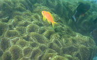
117 hard coral species have been recorded in the
Examples of harvested coral (left). Photo courtesy of Topham, UNEP.
Around 250metres3 of coral is quarried from the
http://www.oceansatlas.org/cds_static/en/gulf_mannar_india__en_19407_all_1.html
The Gulf of Mannar Biosphere Reserve covers an area of 1,050,000 hectares on the south-east coast of
The inhabitants are mainly Marakeyars, local people principally engaged in fisheries. There are about 47 villages along the coastal part of the biosphere reserve which support some 100,000 people (200,000 seasonally as of 2001). The Global Environmental Facility (GEF) has provided support to the establishment of the biosphere reserve, including the setting up and functioning of the
Major habitats & land cover types
Sea grass beds dominated by Hydrocharitaceae and Potamogetonaceae, Halodule uninervis, Cymodocea rotunda, C. serrulata etc.; coral reefs; mangroves including Rhizophora conjugata, Avicennia alba, Bruguiera gymnorrhiza, Ceriops tagal, Lumnitzera racemosa etc.
Year designated: 2001
http://www.unesco.org/mabdb/br/brdir/directory/biores.asp?mode=all&code=IND+02
The Gulf of Mannar Marine Biosphere Reserve was established by the Government of India and the State of
The Reserve harbours marine biodiversity of global significance and is renowned for its coral reef, sea grass and algal communities. These habitats provide excellent foraging habitat for marine turtles and green, olive ridley, hawksbill, loggerhead and leatherback turtles have all been recorded there. The islets and coastal buffer zone also include beaches, estuaries, salt marshes, mangroves and tropical dry broadleaf forests.
The Gulf of Mannar Marine Biosphere Reserve was established by the Government of India and the State of
Sea turtle tracking map http://www.seaturtle.org/tracking/maps/thumb/64698.gif
The Reserve harbours marine biodiversity of global significance and is renowned for its coral reef, sea grass and algal communities. These habitats provide excellent foraging habitat for marine turtles and green, olive ridley, hawksbill, loggerhead and leatherback turtles have all been recorded there. The islets and coastal buffer zone also include beaches, estuaries, salt marshes, mangroves and tropical dry broadleaf forests.
http://www.mcsuk.org/marineworld/trackturtle/gulf+of+mannar+biosphere+reserve
The Gulf of Mannar and its 3,600 Species of flora and fauna is one of the biologically richest coastal regions in all of mainland of
It is equally rich in sea-algae, sea grasses, coral reef pearl banks, fin & shell fish resources, mangroves, and endemic & endangered species. It is an important habitat for the highly endangered sea mammal, the Dugong dugon commonly called as sea cow.
There are 137 species of Corals found in
Sponges, although at casual glance look like plants, are animals, living singly or in colonies of many individuals. Their colours vary as much as shape, being green, red, yellow, and even black or white. In the crevices, these sponges are found with many animals, ranging from tiny crabs and brittle star to bivalve mollusks. 275 species under 8 orders are found in
The Gulf of Mannar (GoM) (Fig.1), which is the first Marine Biosphere Reserves established in
1. Mandapam Group (7 islands) : Musal, Manoli, Manoliputti, and Poomarichan Pullivasal, Krusadai and Shingle.
2. Keezhakkarai group (7 islands): Yaanaipar, Vallimunai, Poovarasanputti, Appa, Thalaiyari, Vaalai and Mulli.
3. Vembar Group (3 islands): Upputhanni, Pulivinichalli and Nallathanni.
4. Tuticorin Group (4 islands): Vaan, Koswari, Kariyachalli and Velanguchalli.
OBJECTIVES OF THE STUDY
· Rapid assessment of status of corals in
· To compare the data with earlier available baseline information to assess the impacts of tsunami on the degree of cover, and composition of live corals and associated benthic organisms, and selected physico-chemical parameters.
General observations:
· No significant damage to status of corals;
· The water was clear without turbid nature;
· No unusual water currents;
· Due to strong waves during tsunami few table corals (Acropora cytherea) were tilted and few branches of another species (Acropora intermedia) broken;
· Gravel sand seafloor near the reef area was replaced by about 1 cm thick fine sand.
· No sand or other debris deposited on the branching and massive corals; and
· No impact on sea grass beds near the reef areas, but due to strong wave action more sea grass fragments were washed ashore.
REMARKS
In general, Tsunami impact has been observed in the coastal region in
1. English. S, Wilkinson. C, Baker. V (eds). 1997. Survey manual for Tropical Marine Resources. Published by Australian Institute of Marine Science: 390 pp.
2. J.K. Patterson Edward, Jamila Patterson, M. Venkatesh, G. Mathews, C. Chellaram and Dan Wilhelmsson (2004). A field guide to stony corals (Scleractinia) of Tuticorin in Gulf of Mannar,
http://www.ramnad.tn.nic.in/biosphere.htm
http://sethusamudram.gov.in/PeterArticle.asp
CORAL REEFS DISTRIBUTION
(GULF OF MANNAR )
The Gulf of Mannar has a chain of 20 islands located between 8 º 48' N, 78 º 9' E and 9 º 14' N, 79 º 14' E on the southwest coast of
All islands in the
The
Mangroves are found on all islands and are particularly extensive in the Mandapam group.
Status of Reef & disturbance / deficiencies:
The high turbidity of the water due to large scale coral mining and coastal erosion from mainland cause deterioration of the reefs.
Exploitation of coral & shells for lime industries and hunting of dugong & turtles is still prevalent.
Most of the islands have no freshwater and are therefore uninhabited. The most productive chank and pearl oyster beds in
Chank or turbinella pyrum (a species unique to
http://envfor.nic.in/report/0102/ar-fig30.jpg
http://envfor.nic.in/icrmn/dist/mannar.html
Coral reefs at Mandapam near Kurusadai island in the
Often referred to as a "biologist's paradise" Kurusadai island is said to exemplify the biological wealth of the
A sea anemone in Kurusadai.
http://www.hinduonnet.com/fline/fl2006/stories/20030328001206500.htm
Coral reef at northeast of Single island
“Along the coast of Gulf of Mannar, sea cliffs have been observed in Mandapam, Rameswaram, Pudumatam and
A sanctuary with a difference, the
http://www.hindu.com/mp/2006/11/20/stories/2006112000010300.htm
http://www.gisdevelopment.net/application/geology/geomorphology/ma06_259a.htm
Habitats of seacow (Dugong-Dugon) http://sethusamudram.gov.in/Images/Map6.jpg
Habitats of Sea grass http://sethusamudram.gov.in/Images/Map7.jpg
Source: World atlas of seagrasses [Fig. 9.1 notes Abundance of seagrass species at various depths in the
State : Tamil Nadu
Area : 10,500 sq. km.
Endemic Flora : Morning glory, Jatropha, Halophila grass
Endemic Fauna : Sea Cow, Sea Anemone, Sea fans
The Gulf of Mannar reserve is the first marine Biosphere Reserve established in
Flora
About 160 species of algae have been recorded here of which some 30 species are edible seaweeds. The area is also rich in sea grasses which provide food for sea mammals, particularly the dugong. The mangrove vegetation of the islands consists of species of Rhizophora (Red mangrove), Avicennia (Black mangrove) , Bruguieria (Large-leaved orange mangrove), Ceriops (Tagal mangrove) and Lumnitzera (
Fauna
The Gulf area has beautiful coral reefs that harbour a wide variety of marine vegetation and animals. Productive beds of pearl oysters, prawn species, edible bivalves, sea anemones, ascidarians and the sea cow (Dugong dugon) occur in the Reserve.
Among the fauna, the invertebrates are represented by 280 species of sponges, 92 species of corals, 22 species of sea fans, 160 species of polychaetes, 35 species of prawns, 17 species of crabs, 7 species of lobsters, 17 species of cephalopods and 103 species of echinoderms.
Threats
Illegal coral mining for cement industries and indiscriminate collection of sea grass is the main threat to the reserve. 65% of the existing coral reefs in the area are dead, mostly due to human interference.
http://www.cpreec.org/04_phamplets/21_biosphere%20reserves/biosphere%20reserve.htm
Coral in the
Pamban island in the
What Alignment 4 means:
Malabar Bowen map (1747) drawn by
Map drawn by Joseph Parks, Australian Botanical explorer (1788) shows Ramar Bridge (Map in Sarasvati Mahal Lib., Thanjavur)
Map of 1804, by James Rennel, First Surveyor General of
Source: Asiatic Society, 1799, Asiatick Researches: Or, Transactions of the Society Instituted in Bengal, P. 52 refers to the bridge called Setband (alt. spelling, setuband like Allahband; setu-bandha), broken in 3 places. It also notes “The people call it a bridge; or otherwise it appears to have wood growing on it, and to be inhabited.”
Religious and cultural sites, 8th-12th centuries http://dsal.uchicago.edu/reference/schwartzberg/pager.html?object=071 Schwartzberg Atlas, p. 34.
Islamic expansion and changing Western views of
Setupati coinage, 16th and 17th century Obverse: Sri Ganapati, seated.Reverse, in Tamil, Se-Tu-
(Nagaswamy R. 1979. Thiruttani and Velanjeri Copper Plates. State Dept. Of Archaeology, Tamilnadu.
Translation of Section 14 of Velanjeri copper plate of Paraantaka Chola I issued in the 25th year (that is, about 930 Common Era) is as follows:
“This ruler (Paraantaka) performed tulaabhaara with gold acquired by his valour, at the beautiful Sriraamatirtha, where the ablest of monkey flocks built the bridge; at the Kanyaatirtha which subdued the southern quarters, and at Srirangam beautiful by the areca groves, where Sri Vishnu reclines on his serpent couch.”
Sanskrit text in grantha script of this section reads as follows:
“ramie sriramatirthe kavivara nikaraih baddhasetu prabandhe kanyaatirthe jitaanaamadaritamapi dis’e mandane dakshinasyaah srirange caahis’alyaas’ayitamurabhidi s’yaamapoogaabhiraame hemnaaviryaancitena kshitipatikarot yastulaabhaarakarma”
Udayendiram plates of Cola king Parantaka I (AD 907-955) refer to his adoption of the title Samgramaraghava like Rama.


